The Old City by night is very different from the daytime version.
 The tall columns of the Byzantine Cardo cast spooky shadows.
 As part of their training, soldiers learn about Israel and Jerusalem.
 The guide is probably telling the young men and women that they stand on the 6th century Byzantine Cardo, which was the continuation of the Roman Cardo.
 The Latin term cardo means pivot/"hinge"/axis, and by extension, the street around which city life revolves.
. The Romans were big on urban planning and almost every city they built throughout the Empire had a cardo crossing the city from north to south.
 The Latin term cardo means pivot/"hinge"/axis, and by extension, the street around which city life revolves.
.
I wonder if pagan Roman Jerusalem had as many cats as the Old City does today.
.
 The Romans were big on urban planning and almost every city they built throughout the Empire had a cardo crossing the city from north to south.
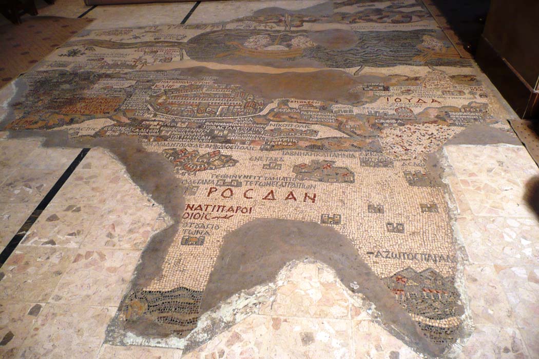
 You can see Jerusalem's main cardo, secondary cardo, and the recently discovered decumanus on the old Madaba mosaic map.
.
Jerusalem's Cardo Maximus was a wide stone-paved road with sidewalks, colonnades (a series of regularly spaced columns supporting an entablature and usually one side of a roof), and shops along its length.
.
These wooden bits in the photo were reconstructed to show how a shop would have been covered to keep merchandise dry in the winter and to shield merchants from the blazing summer sun.
The pigeon up there thinks it's a perfect perch!
How do you say pigeon in Latin?
.
.
With its animals and shadows, this post is for Camera-Critters and Shadow Shot Sunday memes.
.